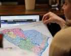
The air in the South Carolina State House carries a specific weight, a mix of floor wax, old paper, and the heavy humidity that clings to the Lowcountry. In a room tucked away from the grand marble staircases, a group of people sat around a table covered in maps. These weren't just maps of roads or rivers. These were maps of power.
Redistricting is often described as a math problem or a legal hurdle. That is a lie. It is a blood sport played with highlighters. It is the process of deciding whose front porch belongs to which representative and, by extension, whose voice carries the weight of a shout and whose is muffled to a whisper.
Usually, the script is predictable. The party in power looks at the census data and carves out a map that ensures their survival for the next decade. They look for "safe" seats. They look for "influence." And usually, when the most powerful man in the national party speaks, everyone else falls in line. But in Columbia, something broke the rhythm. Donald Trump wanted a scalp. He wanted a map that would punish his enemies and reward his loyalists with surgical precision.
The South Carolina Republicans looked at the demands. Then, they looked at the law. Then, they did something that feels increasingly alien in modern American life. They said no.
The Ghost in the Geography
Imagine a woman named Elena living in a small, clapboard house in a district that has shifted three times in twenty years. To Elena, a map isn't a political strategy; it’s a question of whether her representative knows that the creek at the end of her street floods every time it rains for more than twenty minutes.
When national figures demand "aggressive" redistricting, they aren't thinking about Elena’s creek. They are thinking about "efficiency gaps" and "partisan leans." They see a sea of red and blue pixels. The local legislators, however, are the ones who have to stand in the grocery store line and explain to their neighbors why their community was sliced in half to satisfy a spreadsheet in Florida or Washington.
The tension in South Carolina wasn't just about party loyalty. It was a collision between the national desire for total political warfare and the local reality of governing a state that still values its own idiosyncratic traditions. Trump’s team pushed for a map that would maximize Republican gains by aggressively "packing" and "cracking" districts—terms used to describe the grouping of like-minded voters into one area or scattering them so thin they lose all influence.
The state’s Republican leadership, led by figures who had spent decades navigating the specific nuances of South Carolina’s coastal and upstate divides, saw a trap. An overly aggressive map isn't just a political statement; it’s a legal target. In the South, the ghost of the Voting Rights Act still haunts every pen stroke. A map drawn too greedily is a map that ends up in federal court, where judges—not politicians—eventually take over the drawing process.
The Calculus of Defiance
Politics is a game of risk management. For the South Carolina GOP, the risk of defying a former president was significant. Trump’s influence in the Palmetto State is not a suggestion; it is a force of nature. He can end a career with a single post on social media.
Yet, the legislators leaned into a different kind of logic. Consider the math of a "safe" seat. If you draw a district that is 70% Republican, you have a fortress. If you try to draw two districts that are 52% Republican, you have a gamble. Trump’s demands leaned toward the gamble. He wanted to push the boundaries, to flip seats that had been held by Democrats for years by stretching Republican voters as thin as possible.
The state leadership looked at the long game. They chose the fortress over the gamble.
This wasn't an act of sudden progressivism or a move toward "fairness" in the way an activist might define it. It was an act of cold, hard institutionalism. They realized that by following the national mandate for a scorched-earth map, they were inviting a decade of litigation that could eventually lead to a map far less favorable than the one they could draw themselves.
They chose the quiet power of the status quo over the loud power of the revolution.
The Invisible Stakes
We often talk about democracy as a grand, sweeping ideal, but it is actually made of ink and paper. When a map is drawn, it determines where the money goes. It determines which schools get the new gymnasiums and which highways get the fourth lane.
When the South Carolina Republicans opted for a more "conservative" map—conservative in the sense of being cautious and legally defensible—they were protecting their own flanks, but they were also acknowledging a fundamental truth about their state. South Carolina is a place where "who you know" matters as much as "what you vote for." By refusing to radically redraw the lines, they kept communities of interest together. They kept the social fabric from being shredded for the sake of a national headline.
There is a specific kind of courage found in the mundane. It isn’t the courage of a soldier on a battlefield; it’s the stubbornness of a bureaucrat who refuses to sign a document they know is flawed. The legislators faced immense pressure. They were called RINOs (Republicans In Name Only). They were threatened with primary challengers.
But they held. They produced a map that looked remarkably similar to the one that existed before, with minor tweaks to account for the massive population growth in places like Charleston and Myrtle Beach. They prioritized stability over expansion.
The Echo in the Chambers
What happens when the center holds against the fringe? Usually, nothing loud. There are no parades for people who choose the middle path of legal pragmatism. Instead, there is just the continuation of the work.
This defiance is a signal. It suggests that the "fever" of nationalized, personality-driven politics has a ceiling. That ceiling is the reality of state law and the practical desire of local leaders to remain in control of their own destinies. It’s a reminder that while the President or a former President can dominate the news cycle, the people sitting in the committee rooms in state capitals still hold the keys to the kingdom.
The maps were eventually signed into law. The national pundits moved on to the next outrage. But the precedent remains. In a small corner of the South, the line drawers decided that their maps belonged to the people of South Carolina, not to the whims of a single man.
It wasn't a revolution. It was something much rarer. It was a boundary.
The maps are now locked in. The districts are set. Elena’s house stayed where it was, and the creek still floods. But for one brief moment in the humidity of Columbia, the machinery of a national movement ground to a halt because a few people decided that the lines on the paper had to mean something more than just a win for the team. They had to be a reflection of the place they actually lived.
In the end, the maps aren't just about who wins the next election. They are the blueprints of our shared life. When those blueprints are drawn with a steady hand instead of a shaking one, the house stands a little longer.
The ink is dry now. The maps are hanging on the walls of election offices from the Blue Ridge Mountains to the Atlantic coast. They look like simple shapes—jagged edges and smooth curves. But they are actually a testament to the fact that, occasionally, the local reality is too heavy to be moved by a national wind.